
Real Estate Intelligence for Every US Parcel
Land Owl gives you instant access to 160M+ US properties with county-verified data from county-verified sources. Search ownership, zoning, infrastructure overlays, and AI insights in seconds.
County-verified US data
Parcel data and zoning intelligence with direct county links
Every property type
Residential, commercial, industrial, agricultural parcels
Infrastructure intelligence
15+ layers including utilities, zoning, environmental data
Trusted Data
- 160M+ Parcels
- All 50 States
- County-verified data
- 7-day free trial
- Cancel anytime
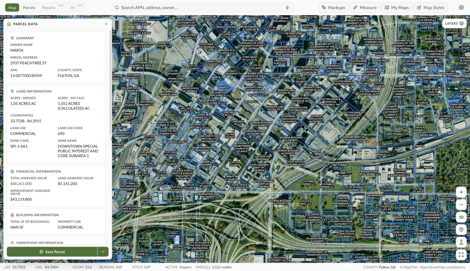
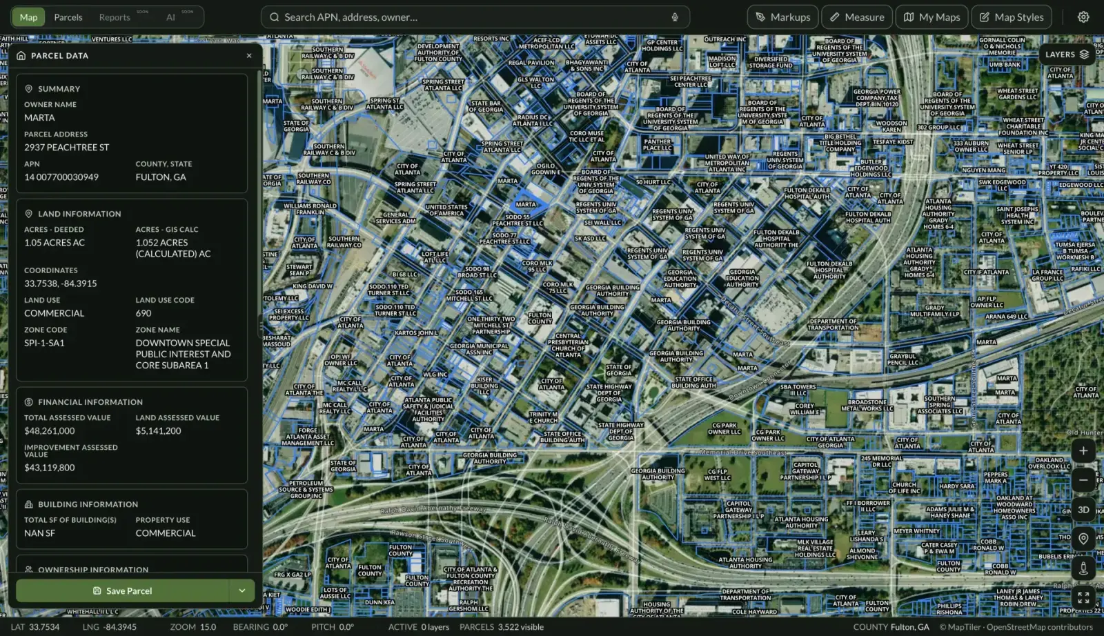
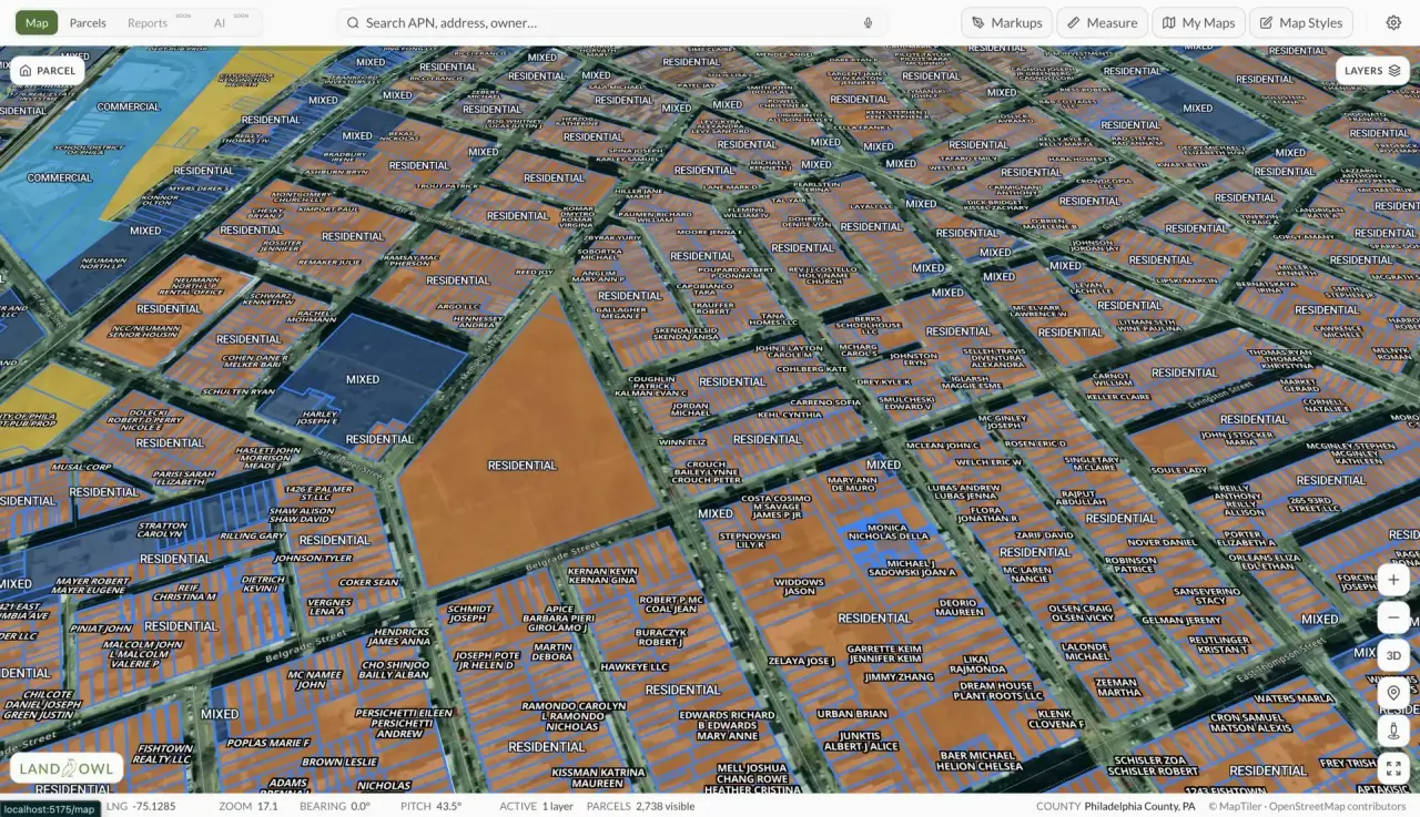
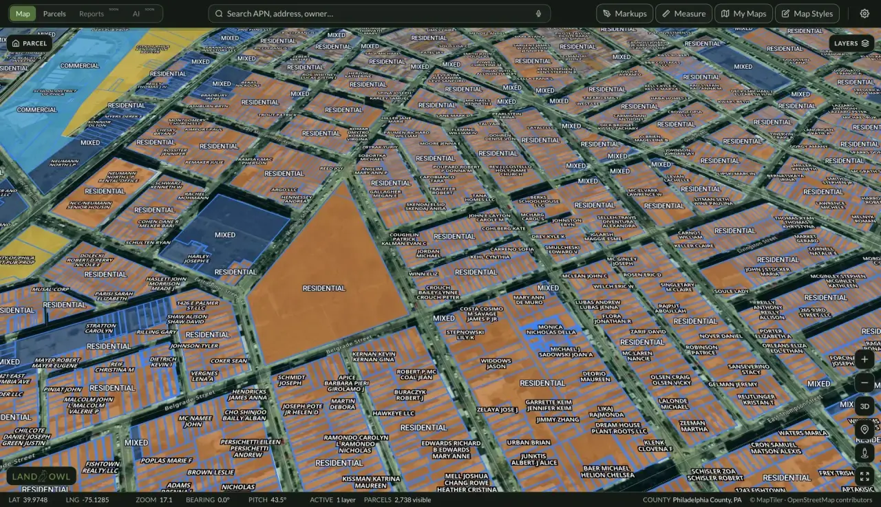
160M+ Properties, County-Verified Data
Access the most comprehensive US real estate database with county-verified data. Every parcel includes direct county links, ensuring you're viewing the most accurate, up-to-date information available.
- County-verified ownership, sales, and valuation data
- Residential, commercial, industrial, and agricultural parcels nationwide
- Direct county assessment links for primary source verification
- Filter by 30+ attributes: ownership, zoning, size, value, sales history, and more
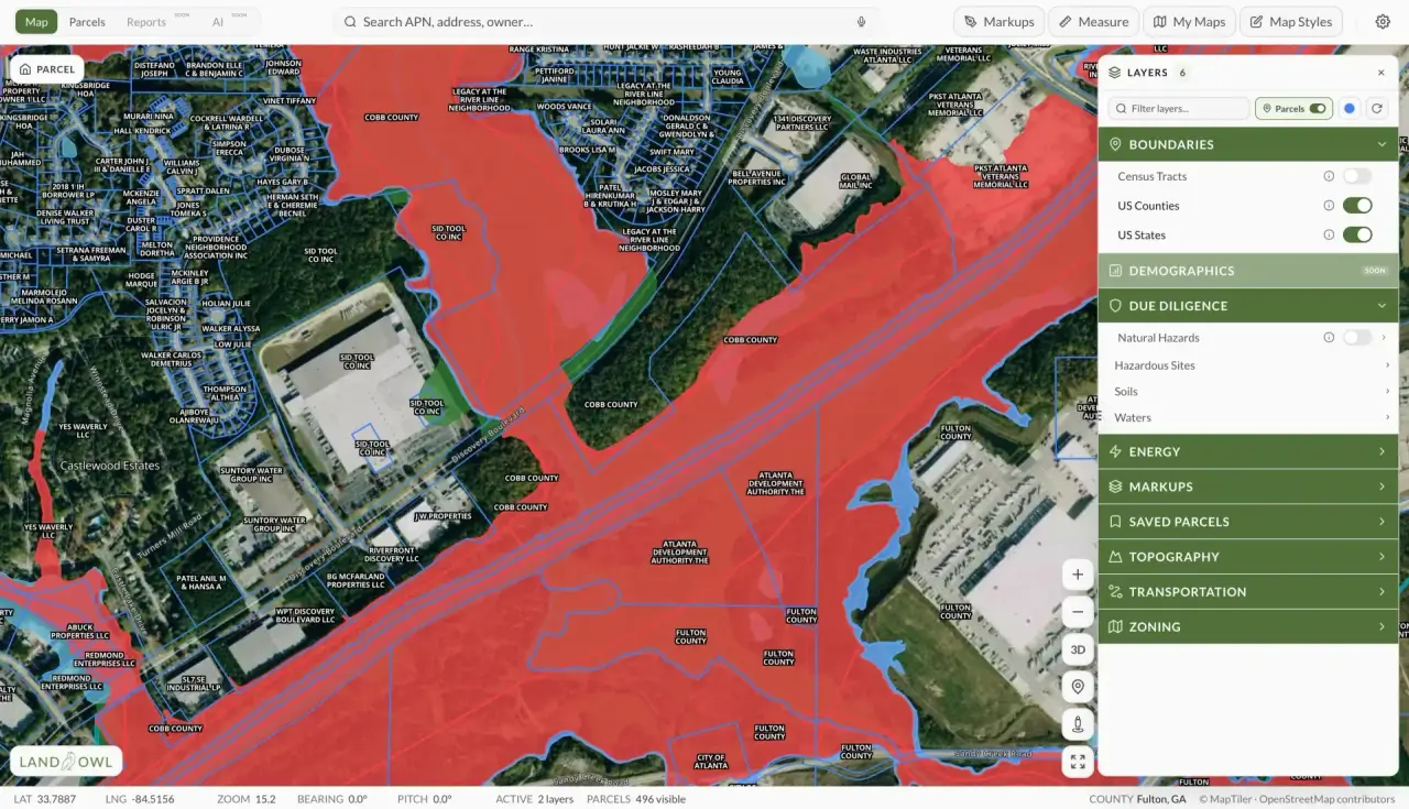
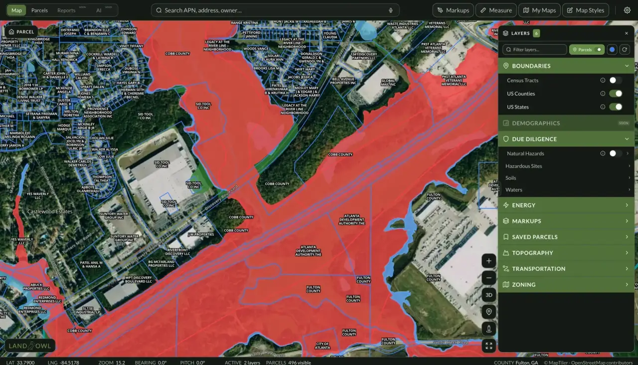
Know Exactly What You Can Build
Access comprehensive zoning data for every US parcel. Understand permitted uses, setbacks, height restrictions, and overlay zones before you buy — eliminating costly surprises.
- Comprehensive zoning classifications and permitted uses
- Interactive zoning overlays with detailed use restrictions and requirements
- Infrastructure layers: Energy (transmission lines, substations, gas pipelines)
- Environmental factors: Flood zones, wetlands, soil drainage, critical habitat
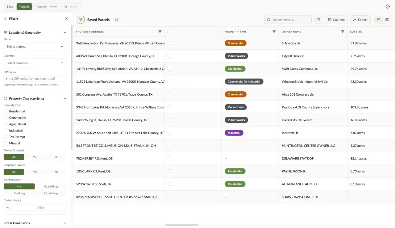
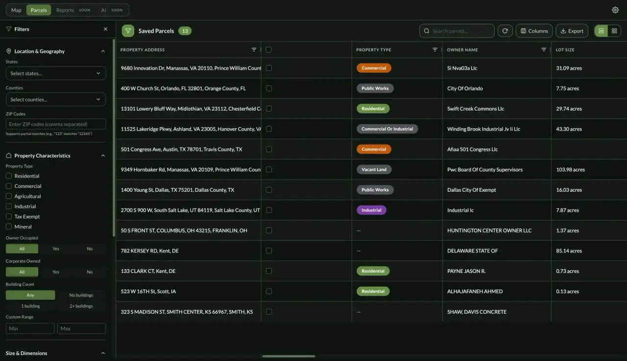
Build and Analyze Your Real Estate Portfolio
Save up to 10,000 parcels with custom tags, notes, and analysis. Track ownership changes, compare properties, and export comprehensive reports for investors, lenders, or stakeholders.
- Save properties with custom names, tags, and detailed due diligence notes
- Track multiple properties: residential developments, commercial sites, industrial parks
- Compare parcels side-by-side with valuation, zoning, and infrastructure data
- Export portfolio reports to CSV, Excel, or PDF for presentations and analysis
Latest from our blog
Insights, market analysis, and how-to guides to help you make smarter real estate decisions.
The Invisible Housing Market: How Smart Investors Find Off-Market Land
The best land deals never hit the MLS. Here's how experienced investors source off-market parcels, why sellers prefer quiet transactions, and how to build a pipeline that finds deals before the competition even knows they exist.
Land OwlMay 27, 20269 min read
How Small Investors Can Compete With Bigger Real Estate Players in 2026
Big players have capital and scale. Small investors have something they can't easily buy: speed, flexibility, and the ability to make a decision without scheduling a committee meeting.
Land OwlMay 14, 20269 min read
Easements 101: The Invisible Lines That Can Kill Your Deal
Easements give someone else a legal right to use part of your property. Most buyers don't realize they exist until they try to build, improve, or sell.
Land OwlMay 14, 20268 min read

Frequently Asked Questions
Everything you need to know about Land Owl. Can't find your answer? Contact our team →
What is Land Owl?
Land Owl is a real estate intelligence platform giving you instant access to 160M+ US parcels with county-verified data, zoning intelligence, infrastructure overlays, and AI-powered insights — all in one geospatial tool.
How does the free trial work?
Start a 7-day free trial without entering a credit card. You'll have full access to the platform during your trial. If you don't subscribe at the end, your account simply pauses — no charge, no surprise.
What data layers are included?
15+ active layers: parcels, zoning, ownership, sales history, flood zones, wetlands, soil drainage, transmission lines, gas pipelines, power plants and substations, plus AI insights and comparable property analysis.
Can I export my data?
Yes. Export saved parcels and reports to CSV, Excel, or PDF for presentations, due diligence packages, and stakeholder analysis.
How accurate is your parcel data?
Every parcel includes direct county assessment links so you can verify the primary source. Data is refreshed regularly from county sources to keep ownership, valuation, and zoning current.
Can I upgrade or downgrade my plan anytime?
Yes. Switch plans at any time from your account settings. Upgrades take effect immediately; downgrades take effect at the next billing cycle.
Is my data private and secure?
Yes. All traffic is encrypted with 256-bit SSL. Your saved parcels, tags, and notes are private to your account and never shared with other users.
Transform how you research land.
Join thousands of investors, developers, and land professionals using Land Owl to find off-market deals faster — with county-verified data on every parcel.
- 7-day free trial
- Cancel anytime