
Why it matters when buying land
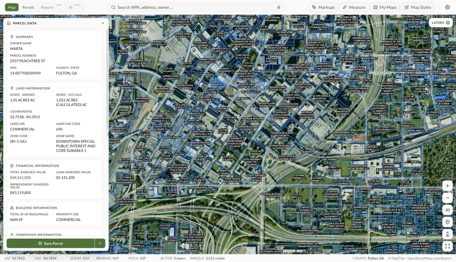
Cadastral maps are how you see land ownership at a glance: where one parcel ends, the next begins, and how a property relates to roads, water, and its neighbors. Nearly every online parcel viewer, including Land Owl, is built on cadastral data.
They are indispensable for research but have a known limitation: they are compiled for tax administration, not boundary law. Parcel lines on a cadastral map can be off by a few feet — occasionally much more — compared to where a surveyor would place them.
Understanding that distinction keeps you out of trouble: use cadastral maps to find, compare, and evaluate land, and use surveys to settle exactly where lines fall on the ground.
How to check it
Most counties publish their cadastral data through an assessor or GIS website where you can look up any parcel by number, owner, or address. In Land Owl, the parcel boundaries on the map are drawn from this cadastral data and are paired with parcel ownership data, so you can identify a parcel and its owner directly from the map.
To verify what the map shows, pull the source records: the recorded plat or deed contains the legal description the cadastral lines were digitized from.
Where precise boundaries matter — building near a line, fencing, or a dispute — commission a licensed boundary survey rather than relying on mapped lines.
See it on a real parcel
Land Owl overlays zoning, ownership, flood risk, and more on every parcel — before you commit a dollar.
What is the difference between a cadastral map and a plat map?
A plat map is a recorded legal document showing how a specific tract was divided into lots, with surveyed dimensions — it is part of the chain of title. A cadastral map is the jurisdiction-wide compilation of all parcels, assembled by the assessor from plats, deeds, and surveys for tax mapping.
In short: the plat is a legal source document for one subdivision; the cadastral map is an administrative index of everything, built from documents like plats.
How accurate are cadastral maps?
Accuracy varies by county and by how the data was compiled. Parcels digitized from modern surveys can be within a foot or two; lines traced from old paper maps in rural areas can be off by tens of feet.
Cadastral maps are generally reliable for parcel shape, relative position, and approximate size — and unreliable as evidence of exactly where a boundary sits. Counties typically publish them with explicit disclaimers to that effect.
Where does cadastral map data come from?
County assessors and GIS departments build parcel layers from recorded plats, deeds, surveys, and historical tax maps, then update them as land is split, merged, or resurveyed. In the western United States, the underlying framework is usually the Public Land Survey System of townships, ranges, and sections; older eastern states rely on metes-and-bounds descriptions.
Commercial providers aggregate these county layers into nationwide datasets, which is how a single map can show parcels across thousands of counties.
Can I use a cadastral map instead of a survey?
For research, yes — finding parcels, checking acreage and ownership, comparing neighboring properties, and screening land before a visit. For anything with legal consequences, no.
Building placement, fence lines, easement locations, and boundary disputes all turn on the surveyed boundary, which only a licensed surveyor can establish. Think of the cadastral map as the index and the survey as the authority.