
Why it matters when buying land
Street addresses are unreliable for land — vacant parcels often have no address at all, and rural addresses can map to the wrong spot. The APN is the identifier that ties together a parcel's tax records, ownership history, and mapped boundaries.
When you research, make offers on, or close on land, the APN is how you make sure everyone is talking about the same property. Deals have gone wrong because parties relied on a loose description instead of the APN and legal description.
It is also the key for pulling county records quickly and for tracking multiple parcels owned by the same person.
How to check it
Find a parcel's APN on the county tax bill, on the deed, or through the county assessor's website — most counties offer a free parcel lookup by owner name or address.
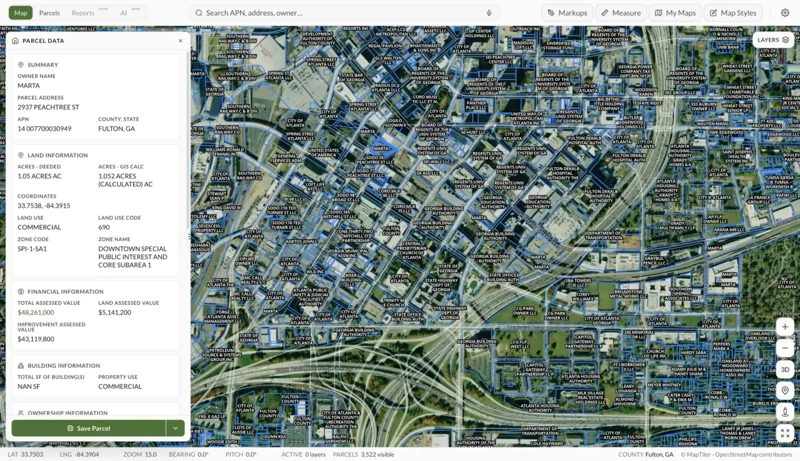
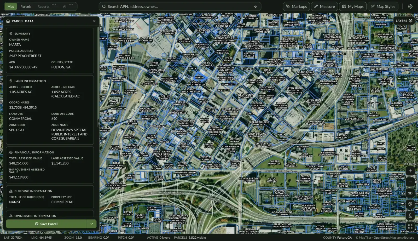
In Land Owl, parcel boundaries and county-verified parcel ownership data are mapped for 160M+ U.S. parcels, so you can locate a parcel on the map and confirm its identity and owner against the assessor's records.
When comparing records across sources, watch the formatting: the same APN may appear with or without dashes or leading zeros (123-456-789 versus 123456789).
See it on a real parcel
Land Owl overlays zoning, ownership, flood risk, and more on every parcel — before you commit a dollar.
Is an APN the same as a legal description?
No. The APN is an administrative tax identifier, while the legal description — metes and bounds, or lot-and-block on a recorded plat — is what legally defines the parcel's boundaries in a deed.
Deeds convey property by legal description; the APN is usually included only for reference. Use the APN for research and the legal description for the actual transaction.
Can a parcel's APN change?
Yes. APNs change when parcels are split, combined, re-platted, or when a county renumbers its tax maps. That means the records for one piece of ground can live under multiple APNs over time — useful to know when tracing the history of land that was ever subdivided.
Why do APN formats differ between counties?
Each county designs its own numbering system, usually encoding the assessor's map book, page, and parcel position — for example, 012-345-678 might mean book 12, page 345, parcel 678. There is no national standard, so the same parcel can show differently formatted versions of the same number in two datasets.
Always match on the county plus the normalized number, not the raw string.