
Why it matters when buying land
GIS parcel data is how modern land research starts. Instead of pulling deeds one at a time at the courthouse, you can see every parcel in an area — its shape, size, owner, and value — on one map, and filter for exactly the kind of land you want.
It is also how you build context around a specific parcel: who owns the neighboring land, how the parcel relates to roads and water, and whether nearby ownership patterns suggest opportunities like assemblage or off-market outreach.
The critical caveat is precision. GIS parcel lines are mapped for assessment and reference, not surveyed — they can be off by a few feet or, in rural areas with old metes and bounds descriptions, considerably more. They are a research tool, never a substitute for a survey.
How to check it
Most counties publish their parcel data through a public GIS viewer on the assessor or GIS department website, though coverage, freshness, and attribute detail vary widely by county. Some counties still charge for data exports or have no online map at all.
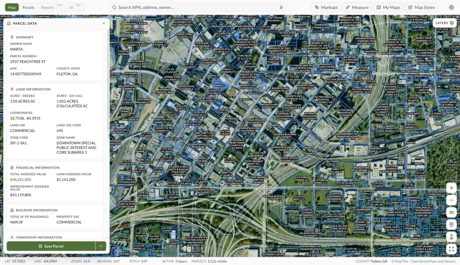
Land Owl aggregates this into one place: the parcel boundaries on the map show every parcel's mapped lines, and the parcel ownership data shows the owner, APN, acreage, and related attributes without hopping between county sites.
For anything that depends on the exact boundary location — building near a line, fencing, or resolving a dispute — verify against the recorded deed and plat, and hire a licensed surveyor. GIS lines are the starting point; the survey is the answer.
See it on a real parcel
Land Owl overlays zoning, ownership, flood risk, and more on every parcel — before you commit a dollar.
Where does GIS parcel data come from?
The base layer comes from county government: the assessor maintains parcel records for taxation, the recorder holds the deeds and plats, and the county GIS department digitizes the boundaries from those documents. Each county maintains its own data, on its own schedule, in its own format.
Commercial providers and platforms then aggregate, standardize, and refresh county data into nationwide datasets — which is what makes searching across county lines possible.
How accurate are GIS parcel boundaries?
Accurate enough for research, not for construction. Parcel lines digitized from modern plats in well-funded counties can be within a few feet; lines derived from old metes and bounds deeds in rural counties can be off by tens of feet or more.
Misalignment with aerial imagery is also common — a fence that looks like it crosses a GIS line may sit exactly on the true boundary. Only a licensed boundary survey establishes the legal line on the ground.
What attributes come with parcel data?
Typical attributes include the parcel number (APN), owner name and mailing address, situs address, deeded or calculated acreage, assessed and market values, land use or property class codes, and sometimes sales history, zoning, and tax status.
Attribute depth varies by county. Owner mailing addresses are especially useful for land buyers — a mailing address far from the parcel often signals an absentee owner who may be open to an offer.
Is GIS parcel data free?
Often, but not always. Many counties publish free public viewers and some offer free bulk downloads, while others sell their data or only provide it on request — policies vary by county and state, and a few states have open-records laws that force the data open.
Aggregated, standardized, multi-county data is generally a paid product because of the work involved in collecting and normalizing thousands of separate county datasets. For most buyers, the practical question is coverage and freshness, not just price.