

Why it matters when buying land
Rights-of-way determine how you — and others — get to and through a parcel. A recorded right-of-way benefiting the land can be the only legal access it has; one burdening the land means traffic, utility crews, or a future road may cross property you thought was entirely yours.
Road rights-of-way are usually wider than the pavement. Part of what looks like front yard often sits inside the public right-of-way, which shrinks the area you can fence, landscape, or build on and is where setbacks are measured from.
For rural land, an old railroad, pipeline, or section-line right-of-way can cut a parcel in two and seriously limit building sites — and it rarely shows up in a casual listing.
How to check it
Order a title search — recorded rights-of-way appear as exceptions in the title report, and the deed or recorded plat often shows their width and location. The county road department or public works office can confirm the platted width of public road rights-of-way.
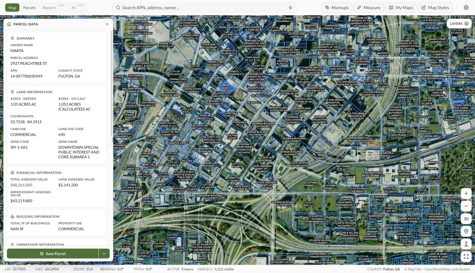
In Land Owl, the parcel boundaries on the map show how the parcel meets roads and neighboring parcels — useful for spotting where a parcel's boundary stops short of the pavement or where a corridor-shaped strip cuts through.
Walk the property and look for physical evidence: utility poles, pipeline markers, graded paths, and rail beds often trace rights-of-way, including some that were poorly documented. A surveyor can mark the exact line where it matters.
See it on a real parcel
Land Owl overlays zoning, ownership, flood risk, and more on every parcel — before you commit a dollar.
What is the difference between a right-of-way and an easement?
A right-of-way is a specific kind of easement — one whose purpose is passage. Every right-of-way easement is an easement, but easements also cover non-travel uses like drainage, utilities buried in place, or conservation restrictions.
The terms blur in practice because some rights-of-way are not easements at all: a state highway department or railroad may own its corridor in fee simple, meaning it owns that strip of land outright.
Who owns the land under a road right-of-way?
It depends on how the right-of-way was created. Where the public holds only an easement, the adjoining owners typically still own the underlying land — often to the centerline of the road — subject to the public's right to use it.
Where the corridor was dedicated or acquired in fee, the government owns the strip itself. The deed, plat, and county road records show which situation applies, and the answer matters if a road is ever vacated.
Can you build in a right-of-way?
Generally no. Permanent structures are prohibited inside a right-of-way, and anything you place there — fences, landscaping, sheds — can usually be removed at your expense when the holder needs the corridor.
Driveway connections to a public road right-of-way typically require an access or encroachment permit from the road authority. Building setbacks are also commonly measured from the right-of-way line, not the pavement edge, which pushes structures further back than buyers expect.
How wide is a typical road right-of-way?
Local rural roads commonly sit in rights-of-way around 40 to 60 feet wide, while highways and arterials can run much wider — there is no universal standard, and widths vary by state, county, and era of dedication. The pavement itself usually occupies only part of the corridor.
Never assume the right-of-way matches the visible road. The recorded plat or the county road department gives the actual width, and a survey shows where the line falls on your side.