
Why it matters when buying land
Wetlands can make parts of a parcel effectively unbuildable. Filling or disturbing regulated wetlands without a permit can trigger federal or state enforcement, restoration orders, and significant penalties — and permits, where available, add cost and months to a project.
Wetlands are not always obvious. A parcel can be dry underfoot most of the year and still meet the wetland criteria through its soils and vegetation, which is why buyers get caught by ground that "looked fine."
For land pricing, the delineated wetland acreage matters more than the gross acreage: a 40-acre tract with 15 acres of wetland is, for building purposes, a 25-acre tract with constraints.
How to check it
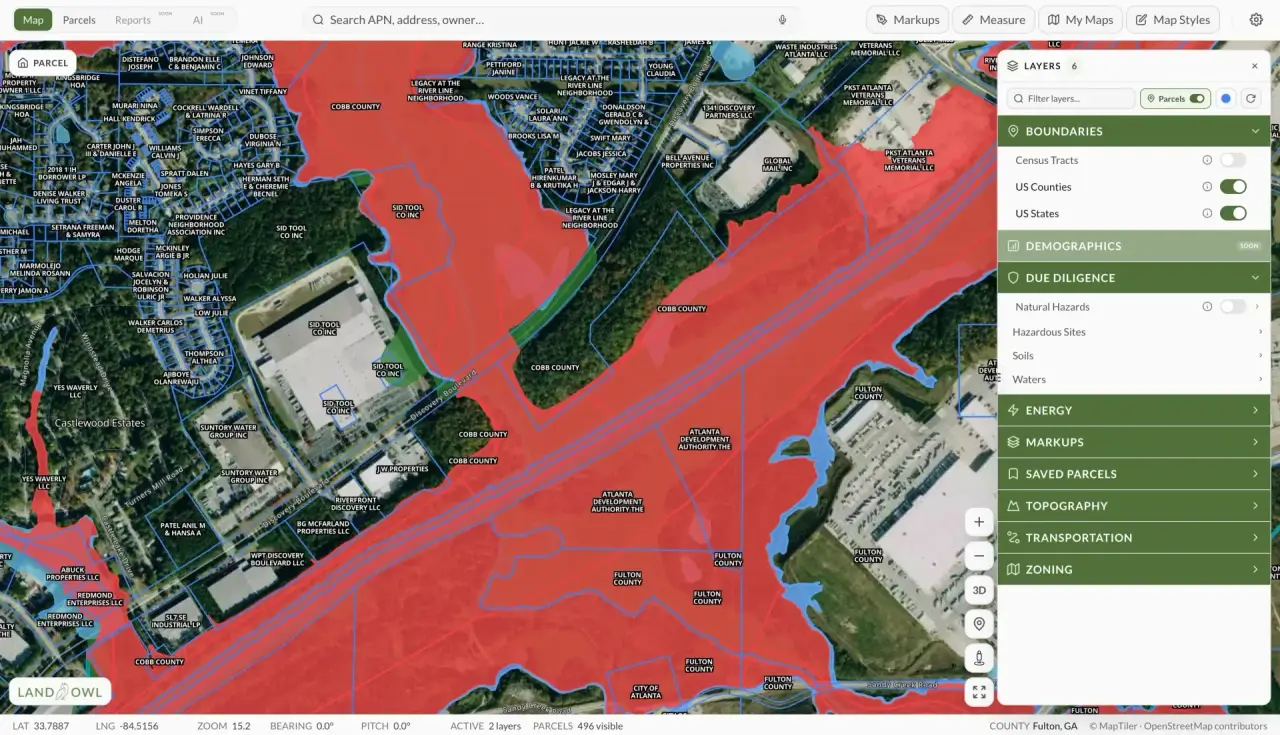
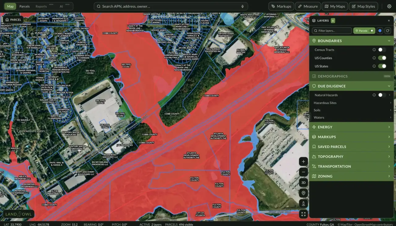
Start with the mapped data. In Land Owl, the wetlands overlay shows National Wetlands Inventory (NWI) areas on the parcel map, and the soil survey layer flags hydric soils — together a strong screening signal for where wetlands are likely. NWI maps are indicative, not definitive: they miss some wetlands and overstate others.
Look for field clues on a walk-through: standing water, saturated soil, cattails, rushes, willows, and water-stained vegetation all suggest wetland conditions, especially in low spots and along drainages.
For a definitive answer, hire a qualified wetland consultant to perform a formal delineation, and — if federal jurisdiction matters to your plans — request a jurisdictional determination from the Army Corps of Engineers, which is the agency's official call on which areas are regulated.
See it on a real parcel
Land Owl overlays zoning, ownership, flood risk, and more on every parcel — before you commit a dollar.
Can you build on wetlands?
Sometimes, but only with permits — and avoiding wetlands is almost always cheaper than permitting through them. Filling regulated wetlands generally requires a federal Clean Water Act Section 404 permit from the Army Corps, and often state or local wetland permits on top, with compensatory mitigation (creating or buying credits for replacement wetlands) commonly required.
Small impacts may qualify for streamlined nationwide permits; larger ones face individual permits that can take a year or more. The practical strategy on most parcels is to delineate first and design the project around the wetlands.
How much does a wetlands delineation cost?
For a typical rural parcel, a professional delineation commonly runs from around a thousand to several thousand dollars, scaling with acreage, terrain, and how intricate the wetland boundaries are. Large or complicated tracts cost more.
A formal jurisdictional determination from the Army Corps adds time but not agency fees, and gives you an official decision you can rely on for planning. Against the cost of redesigning a project — or an enforcement action — delineation is cheap due diligence.
How do I know if a property has wetlands before buying?
Layer the free evidence first: NWI wetland mapping, hydric soil data from the soil survey, FEMA floodplain maps, and aerial imagery showing wet signatures or vegetation changes. If any of it flags the parcel — or the ground looks wet on a site visit — assume wetlands are possible.
Then make the contract do the work: a due-diligence contingency lets you commission a delineation before closing rather than discovering the wetland after you own it. Mapped data screens parcels; only a field delineation draws the actual line.
Who regulates wetlands?
At the federal level, the Army Corps of Engineers administers Clean Water Act permitting for wetlands that qualify as "waters of the United States," with EPA oversight. The scope of that federal jurisdiction has shifted repeatedly through rulemaking and court decisions — most recently narrowing — so which wetlands are federally regulated is a moving target.
Many states and some local governments regulate wetlands independently, sometimes covering isolated wetlands the federal program no longer reaches. The safe assumption for a buyer: a wetland that escapes federal jurisdiction may still be fully regulated by the state, so check both layers.